APPALACHIA AND THE SOUTHERN STATES
It had been another very long cold and wet winter season.
I had been ready for this all winter through.
After having saved up some money over the previous 2 years, I was finally able to purchase the Garmin 590LM GPS unit I had wanted for so long.
After conducting so much research, I knew exactly what I wanted, that would do the job for me in the manner I wanted and I was anxious to put it to the test and get rid of this feeling of buyers’ remorse that I was carrying.
To compliment it, I had also purchased a Sena SMH5 Bluetooth unit to direct all instructions to my helmet-installed headset as well as a new Contour +2 POV camera.
So yeah, armed with a Blue-toothed GPS unit and double-mounted POV cameras on the bike, I daresay I was ready!
It didn’t matter that I was not very proficient at using them.
That would come on the trip. I would gain the necessary skills I needed OTJ! (On The Job!)
After all, touring - for me, is serious business!
I had spent the best part of my forced indoor time due to the cold weather, experimenting and designing the best mounting system that I could, for my POV (Point of View) cameras.
I was looking forward to obtaining some interesting video footage of this trip for myself.
So my dreams of the coming ride began to materialize and I began to plan of where to go and what places of personal interest to visit.
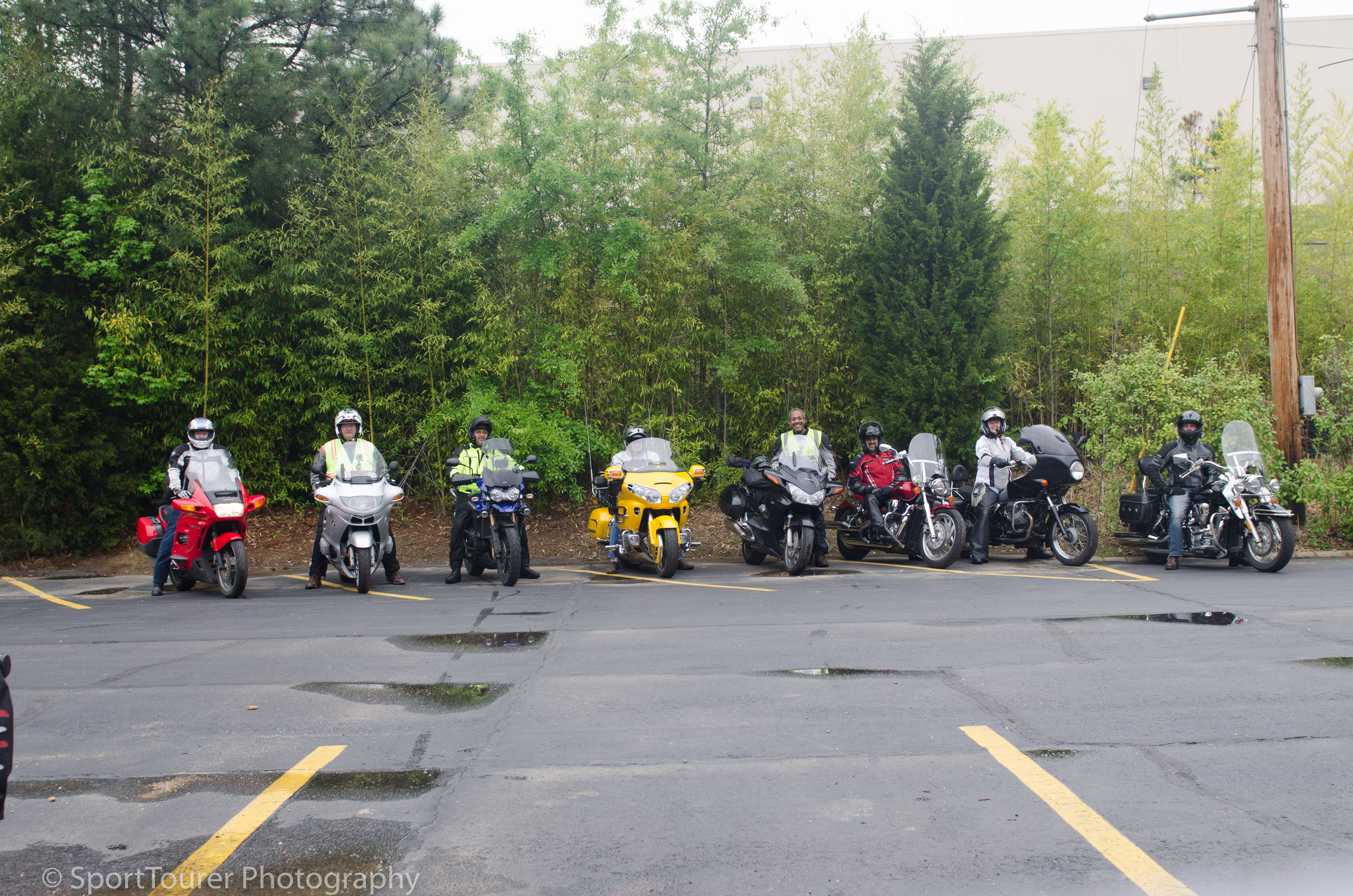
I contacted my group of riding friends from Texas who typically, embarked on an annual group ride right around the middle of April each year.
The group consensus was/is always to defer “Road Captain” status to Tony, who always does a good job of putting these rides together.
This year, the plan was to go to Arkansas and give them the experience of Arkansas roads and countryside.
So as I contemplated my plans, Arkansas could most definitely be on my return track and would make for a good reunion.
I had been contemplating a ride through the Shenandoah Valley for this year. More specifically, a ride along the Skyline Drive and Blue Ridge Parkway (BRP), so I accepted their invitation to meet up in Arkansas.
As plans began to take shape with more and more definite decisions, I turned more attention to weather conditions.
Mid-April in North East Ohio is definitely not similar to Mid-April in Arkansas nor Texas. I felt I could manage because over the years I had invested in some decent riding gear, so this was another chance to experience another ride under different conditions in a different part of the country.
On one hand I was apprehensive. On the other, I was excited.
In determining my choice of dates to travel and eventually meet up with them, I could not overlook weather conditions along the route of choice. Long range weather forecasts called for rain during my 3rd and 4th travel-days.
No big deal I thought. I have the gear and after all, I pay top dollar for the premier wet weather motorcycle tires on the market.
I felt “covered”. I had the confidence.
So I “put in” for my time off work and set about preparing the bike, my gear and myself for the journey ahead.
Time to do it!
Time to get on the road!
Make no mistake, with shutdown duties completed at work, I was not waiting a single day more to embark on my next tour, especially after the long spell of cold winter weather.
April 11th, 2015
Day 1.
It was a cold April morning. Temperatures were in the 40’F (5’C) range but forecast to warm up as the morning and the rest of the day wore on. My return day weather conditions were also forecast to be much warmer, so I felt that if I could brave the cold on the outward leg of the journey, returning home would be a lot more comfortable.
I was packed, loaded and ready to set off at 8:00a.m.
For this trip and today in particular, I had set a destination – Front Royal, VA., via Parkersburg, WV – a distance of 426 miles (682 km). A very conservative distance for the day in relation to my daily mileage of trips gone by. I felt confident.
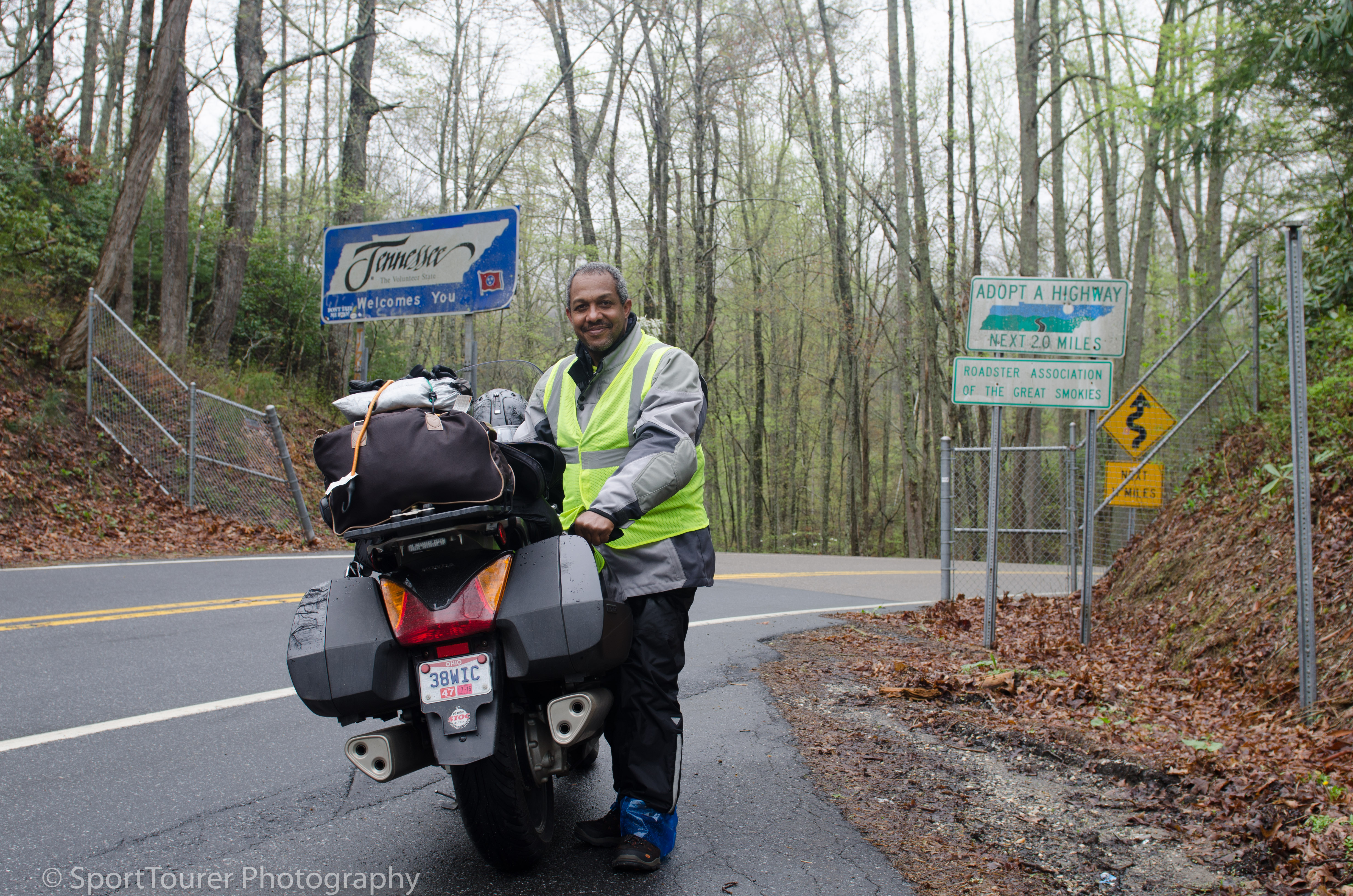
Front Royal is the northern start of the Skyline Drive which then becomes the start of the Blue Ridge Parkway, 105 miles at its southern end.
So leaving home after farewells, it was a cool 48’F (9’C) at 8:45 a.m. when I headed east on interstate 90 and merged onto interstate 77 southbound towards Parkersburg, WV, for a distance of 200 miles (320 km) which came and went by in 3 hours that seemed like no time at all.
As the morning wore on temperatures began to rise and after having been on the road for close to 3 hours, I opted to take a break. I needed it.
I was feeling warm and needed to take off a layer or two of clothing.
I also was feeling rather dehydrated, so this would be a beneficial break/pause in the journey.
So pulling off the highway I found myself in Worhtington, WV where I planned to catch Highway 50 and continue eastwards on my journey.
I pulled into a Gas Mart Station, found some shade under which I parked the bike, got off to stretch my legs and reached into my bag for a snack.
Homemade Roti and Curry wrap, for lunch under a vividly blue sky, in moderate temperatures, bright sunshine and a light breeze?
It doesn't get any better for me at a time like this.
……….. And so for what I received, may the Lord make me truly thankful and please bless the hands that prepared the meal.
What I found in there was a rolled up Roti with Chicken Curry. (It doesn’t get any better than that!)
what a pleasant surprise from my wife. Bless her soul. I said a quiet prayer of thanks for her.
I then washed it all down with a Cherry-flavored Pepsi.
I was set!
I looked around and took in my surroundings and could not miss the blue sky above me.
What a contrast to the dull, grey skies of Cleveland.
I was enjoying this ambience.
So with my belly now filled again and feeling re-charged, I then turned eastward again to start my ride on WV Highway 50.
This was a familiar road to me as I had traveled it before on a return leg of an earlier tour from the east coast.
In this part of the country, it ranked and continues to rank very high on my list of favorite roads as measured by my criteria of safety, road surface quality, thrill factor and scenery.
This route winds its way through the hilly and somewhat mountainous area of West Virginia, snaking its way, twisting and turning through several small mountain towns and offers sweeping views of the mountain country of West Virginia.
This early in the year the weather was still crisp and cool with very little to no spring growth on the trees.
It’s fascinating to me how the trees can look so “dead” at this time of the season with almost no leaves on their branches. But with the pending warmup, there will be an almost instant explosion of growth with leaves sprouting literally from one day to the next.
On this day the trees are void of leaves, soon they will be clothed in a shroud of green.
But today, the trees being bare, I get a unique view of the peaks and valleys along the roadway.
The air is crisp and cool, the temperature gauge on the instrument cluster reports 50’F (10’C). I was well padded with the inner cold-weather liners of my riding jacket. I had on my long-johns and my balaclava to ward off the cold breeze and accompanying colder temperatures being generated from the wind chill factor. Underneath all this, I had 3 separate layers of regular clothing.
I was ready to do battle against these cold conditions of the early morning of this day.
So I got on with the journey and although needing to concentrate totally on the road, I occasionally stole a glance of the views way out on the ridges of the mountains through which I wound along.
the ST got on very quietly with its job, laying the miles down with each passing minute.
Quiet, smooth, powerful and comfortable the bike allowed me to begin relaxing. I could slowly feel the stress reduction. Stress that I always seem to carry on my first day of each journey/ride.
I was looking forward to riding the Skyline Drive and being in the Shenandoah Valley. A place I had read so much about and had been dreaming of visiting so long ago.
Now the time had come that allowed me the privilege and blessing of being able to make that dream come true.
so I pushed on, relishing each twist and turn in the road. The Honda ST13 is truly a delight to ride in these conditions.
The plan for this leg of the journey was to make it to Winchester, VA where I would then catch highway 522 and drop right into Front Royal, VA and find a place to bed down for the night.
(I typically do not book my lodging ahead of time. I prefer to “roll” into a town and then search for a place.
I get the chance to ride around, see more of the different parts of town and people, get a feel for the areas/neighborhoods and then make a judgement call on where to stay after comparing prices.
It has worked well for me so far.)
I settled in for the ride and continued to enjoy the twists, turns and elevation changes of the road.
The day continued to wear on. Temperatures climbed gradually.
by mid-afternoon, I began to feel the effects of fatigue beginning to set in.
Soon I began to feel like I would not be able to make it to Front Royal.
I was aching and really tired.
I realized it was the effects of tiredness at work and the need to for some “time out”. Some much needed time away from work. This was it. And now I needed rest.
At this point the GPS unit directed me to take an exit.
I now was on a narrow, lonely, country road that began to wind its way through a forest, with trees pretty void of leaves.
the late afternoon sunshine filtered through effortlessly, directly into my face.
This meant I was facing west.
But wait a minute. I was supposed to be heading due east!
I looked down at the clock on my instrument cluster. It would be getting close to early evening pretty soon.
I began to get nervous. I had no clue where I was. My fatigue did not help much either. I had to keep backing-up my mind in order to verify all my thought trends at this time.
All of a sudden the reality hit me hard. I was off track!
Having spent so much time planning this trip, I had a pretty fair mental image of the map and an exit at this point was not what I recalled.
Somehow or other I had strayed off my route.
But the unit had not instructed me to turn around or make a U-turn.
I found myself on Highway 48.
I was supposed to be on highway 50.
The sun continued to sink in the afternoon sky. This was not good. The last place I needed to be was here in the “Boonies” when the sun went down. I found a safe enough place along this forest road and made a U-turn. I wanted to find my way back to the point where I exited the previous highway.
The GPS unit still did not instruct a U-turn. I began to feel unsettled. I did not know where I was.
I decided to make another U-turn and stay with GPS guidance.
So I stayed with it along the current path.
The road wound around the side of the mountain I found myself on, going up in elevation, flowing me by some wind turbines and finally filtering me back into a valley, where I promptly pulled into the first gas station I came to. I had just come off Mt. Storm.
The bike needed gas anyway.
Good chance to fill up.
Wise to do so. Plus I needed to shake the cobwebs of fatigue I was experiencing.
It was close to 6:30 p.m.
The evening was rapidly approaching.
I used the opportunity to refer to the map function on my iPhone. This gave me an overview and location of where I was in relation to my originally planned route.

So leaving the station with a better grasp on my current bearing, I got back onto highway 48 where it opened up into some good quality pavement.
I was ready to make up some time. Time I had spent running through the “boonies”.
I took the opportunity and pulled into an “Overlook” parking area to don some additional warm-weather riding gear.
With the evening rapidly approaching, temperatures began to plummet.
The sun started to cast its long shadows and in this part of the mountains where I was, the view was so captivating.
So out with the camera ……………..
The mountainside was lined with wind turbines. A feeling of being back in civilization washed over me, making feel that much more relaxed and ready for this leg of the journey.
Next stop, all things being equal, ought to be Front Royal, VA, my overnight stop for this day. GPS reported that I had 88 miles (141 km) to go.
As tired as I was feeling, I was not too sure I would make it. I was fighting the fatigue/tiredness.
I was literally far away from any major township/city and there was nothing around me or close-by otherwise this would have been the time I would have succumbed to cutting the planned days’ trip short and bedded down for the night.
So I pushed on.
Highway 48 ended up being a pleasant part of the trip/ride. Great asphalt, great evening scenery and several lovely sweeping turns as the road wound its way around the mountainside and through the valleys.
Highway 48 at this time was a welcome reprieve from the “Boonies”.
My shadow was ahead of me, pulling me along, giving me the energy to keep going. From its position ahead of me, it assured me that I was heading in the right direction, eastwards.
As the miles wore on, the traffic got heavier.
I approached and arrived in Front Royal that Saturday night just after 7:40 p.m.
Pulling into a Mickey-Dees, I had a meal and took advantage of their “hot spot” to search for lodging for the night.
I found and booked a room for the night at the Quality Inn Skyline Drive, which was barely 2 miles from where I currently was.
so with formalities dispensed with, I “asked” the GPS unit to take us there.
Much to my dismay, there were no ground, first or second floor rooms available.
This meant I would have to do 3 trips lugging my gear/luggage back and forth from the bike to the room.
As tired as I was, this was a chore. But I had no choice.
At the very least I had a room, it was clean and comfortable. For now that’s all that mattered.
I was off the road and ready for a good nights’ rest.
After a hot shower, sleep came on very rapidly. I was out like a light, but not before checking in with my loved ones to let them know that I was safe and sound. It was now 9:30 p.m. and when I had checked my odometer reading upon arrival, The bike had transported us 477miles on this day. It was 50’F (10’C) a gain of only 2 Fahrenheit degrees (about 1 centigrade degree and a “smidge”) since the start of day.

April 12th, 2015.
Day 2.
I awoke to a lovely Appalachian morning.
I slept in relatively late in an attempt to get more rest that I needed. I was in no great hurry. After all, I was on vacation and had set a conservative agenda for todays’ mileage to be travelled.
it was close to 7:00 in the morning.
The sun was already high in the sky and the air was crisp and fresh. Temperature outdoors was 50’F (10’C).
It felt wonderfully different from being in a big city.
I was looking forward to riding The Skyline Drive on this day.
The Skyline Drive starts here at Front Royal and stretches for 105 miles (168 km) as it snakes its way over and around mountain tops and through the Shenandoah Valley. Its end becomes the start of the Blue Ridge Parkway that runs for a further 364 miles (582 km) to its end at the southern end of the Great Smoky Mountain range.
So with bike/luggage loaded and in place I set off for the day. It was 8:00 a.m. sharp.
It was not hard to find the Skyline Drive. Signs were littered all over the place.
One could not miss it.
So after a couple of intersections and turns I found myself at the northern terminus of the Skyline Drive where it entered the Shenandoah Valley.
I wasn’t even 20 minutes into the ride and I was already being mesmerized by the stunning views of the valley.
It was early April and leaves had not started fully sprouting on the trees that lined the road.
This allowed me expansive views. Stopping at the roadside, I whipped out my camera and began immortalizing the views.


I continued along the road.
With each turn, with each curve that I went around the views presented were just as lovely and breathtaking as the previous, if not, more so.
My stops for photos were becoming frequent.
Subsequently I found myself spending more time than I really should have by making these frequent stops.
My time versus distance travelled ratio began to suffer and I began to realize that at this rate I would not get very far this day.
I had to make a hard decision to find a good compromise. so I pushed on, burning images into my mind.
Stopping to remove camera gear, set up for photography and re-pack camera gear onto the bike requires no less than 12 minutes!
So spending any extra time to take in the surroundings is just that much more time added.
Before you know it, half an hour will have gone by for each stop!
The morning wore on. I was enjoying the ride. I was enjoying the views. I was looking forward to meeting up with family and friends along the way. I was looking forward to riding some fabled motorcycling roads.
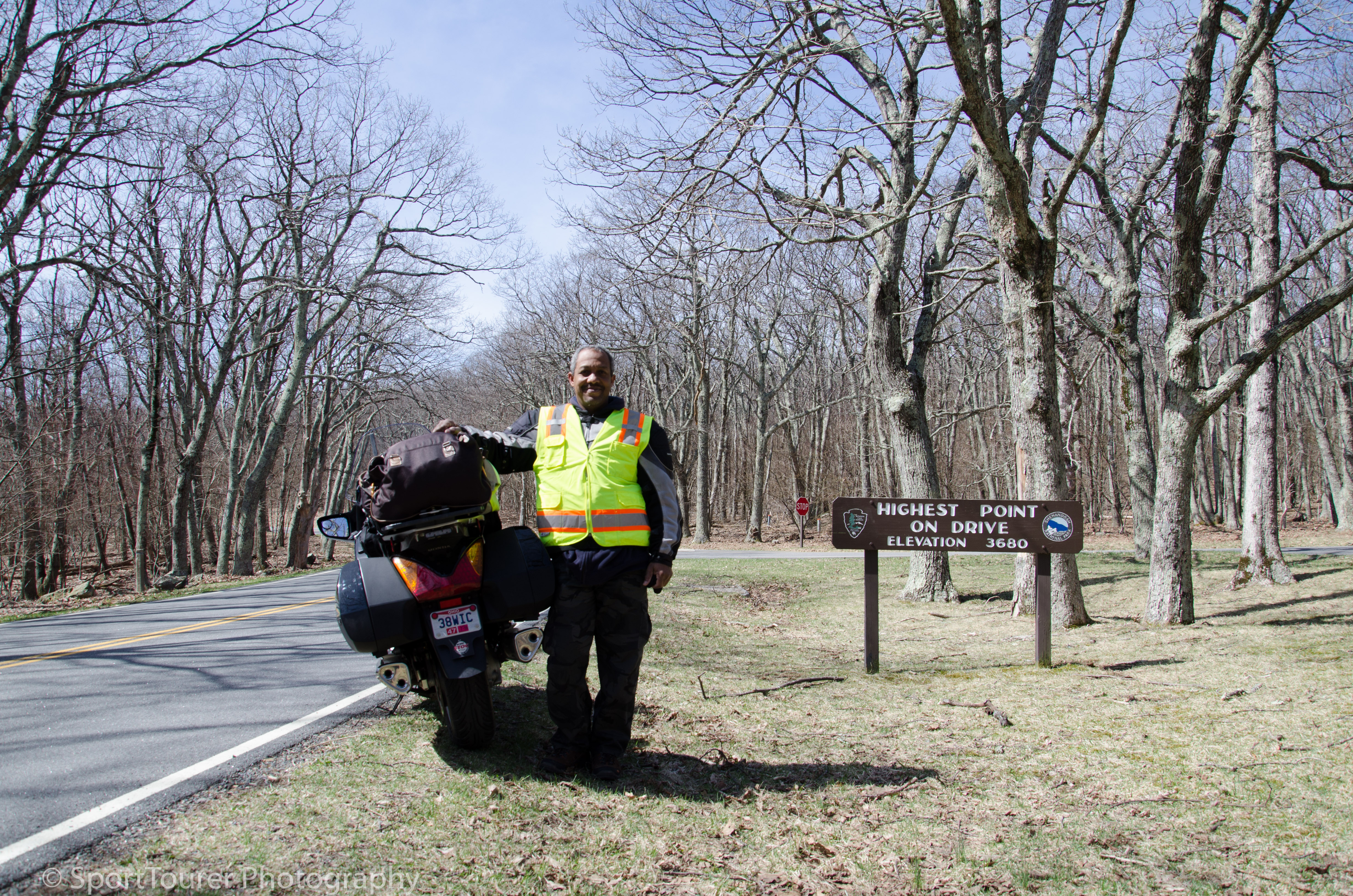
Just after 11 in the morning, I peaked in elevation, finding myself at the highest point of the road through the park at 3680 feet (1121m) in elevation and I particularly wanted, I particularly needed to memorialize my personal achievement with a photo op.
I pushed on for another half hour before my hunger pangs mandated a stop for lunch/a snack of yogurt and bananas that I was carrying.
I found a lovely meadow with a clump of trees nearby under which I sat, and just “took in” my surroundings as I rehydrated and filled my empty stomach.
Times/breaks like this I cherish greatly!
I spent about 40 minutes here on this break from the road. I just couldn’t bring myself to leaving this lovely place. But I had to get on with the journey. I definitely would not like to find myself still on these roads after dark. I still had many miles to go to my final destination for the day.
the views were getting better and better.
Each one more grandiose than the other. I kept stopping. I was in awe of the spectacular sights.
Looking down into the valleys from this perspective was so different.
Views and perspectives not commonly seen in regular day to day life in the big city.
Soon after midday I found myself at the end of the Skyline Drive.
All too soon it came to an end, but oh what views!
Well this meant that I was now at the start of the Blue Ridge Parkway - at a gap in the mountains called Rockfish Gap. Interstate 64 intersects with the Parkway here at this point.
My destination/stopping point for the day that I had chosen, was Afton which was still quite a few miles away.
I began to make my way towards Afton,VA in search of lodgings for the night.
I was deep in mountain territory. Roads were narrow with great elevation changes.
So as the bike knocked down the miles I began to realize that this Afton, VA area was a really tiny place. I don’t know how it made it onto the map. I could not find a single motel/hotel in this locale, so I made an executive decision to move on out of this area till I got to a large enough town to crash out for the night.
Looking down at my instrument cluster I realized that it was 72’F (22’C). No wonder I was starting to feel warm.
I ended up in Waynesboro, VA.
Pulling into a Mickey Dee’s, I went through my tried and tested routine of patronizing them, surfing the net via their hotspot and locating a place to stay.
I checked into the Comfort Inn right around 5:00 p.m.
The ST had munched only 133 miles on this day.
So with phone calls and bedtime prayers dispensed with, sleep soon got the better of me.
April 13th, 2015
Day 3.
The day started out very slowly, caused by my now “unsettled” stomach. It was not the worst. I felt I could manage.
Despite that, as I loaded up the bike for the next leg of the journey, it was a rather beautiful morning.
Breakfast was simple. The usual/standard continental breakfast one finds across most of the motel/hotel chains across the country - Scrambled eggs, assorted juices, sausages, gravy, biscuits, a couple of fruits, yogurt, cereal, waffles and the likes. Take your pick.
I just could not find the appetite to load up on breakfast to start the day off so I settled for a banana and some yogurt which I opted to take along with me for later in the morning.
So at 9:20 a.m. and a warm temperature of 75’F, I set off onto Route 250 back towards Afton and onto the BRP.
Back onto the Blue Ridge Parkway (BRP) I continued to make my way southwards.
I was not even 6 miles (9.6km) into the ride on the BRP when I was greeted with more stunning views again.
A preservation museum was offered. I just had to see and experience it.
It gave me a glimpse into what life was like during the 1840’s for the pioneers that began to settle the country.
No sooner had I left this place was I greeted with more sweeping and stunning views!
I couldn’t do this much longer.
This was too much!
I had to continue my journey and I vowed to be back to visit at a more leisurely pace in future - Good Lord permitting with wealth and health!
So I motored on for another 35 miles along the road till I arrived at the junction of the BRP and Highway 56.
I swung northwards and not long after arrived in Vesuvius, VA.
The road quality was good. The area was very tranquil and well kept up by the local residents.
White picket fences demarcated the individual properties and it projected a sense of pride in their properties.
Crossing the railroad tracks that ran through the area I continued my route which filtered me through Steeles Tavern and on to Raphine, VA right at the junction where interstate 81 runs across.
This afternoon, the interstate would once again be “my friend”. I wanted to make up for time spent oohing and aaahing along the Skyline Dr. and BRP up to this point in time.
So heading southwards once again, the ST took a deep breath, picked up her skirts and downright marched away with me.
We arrived in Marion,VA later that afternoon and with an early check-in at the Econo Lodge on Main St., I turned in early to give my body a little more rest before the next days’ ride.
The sky was laden with thick clouds and threat of rain loomed. It seemed that I had made it off the road at a good time but with only 206 miles (330 km) travelled this day.
April 14th, 2015.
Day 4.
I awoke at 5:40 a.m.
It was 61’F (16’C) and raining!
Today’s plan was to make it out to US 129, a.k.a. “The Tail Of The Dragon” - a notably popular motorcycling road - 314 curves in 11 miles (18 km).
Mixed with the rain was dense fog. Not very pleasing weather at all.
As time passed, the rain did not appear to relent.
2 hours had now gone by and I was becoming agitated.
To go or not to go?
Stay indoors for another day?
I did not have the luxury of time for that.
I had a rendezvous as well with the “Texans” riding up to meet me in Arkansas.
Hmmm. What to do?
I opted to brave the weather. I had to be back home in Cleveland to report for work at a specific time, so I had no choice but to stick with my plan.
I had planned the ride and now I had to ride the plan!
So I loaded up the bike in the rain and fired her up for the morning to begin warming up.
It was approaching 8:00 a.m.
My reflection in the large plate glass window of my motel room revealed that the low beam lamp on the left had burned out.
Shucks!
Hmm. I made a mental note of that to also be prepared for such a situation on future trips. One for the books!
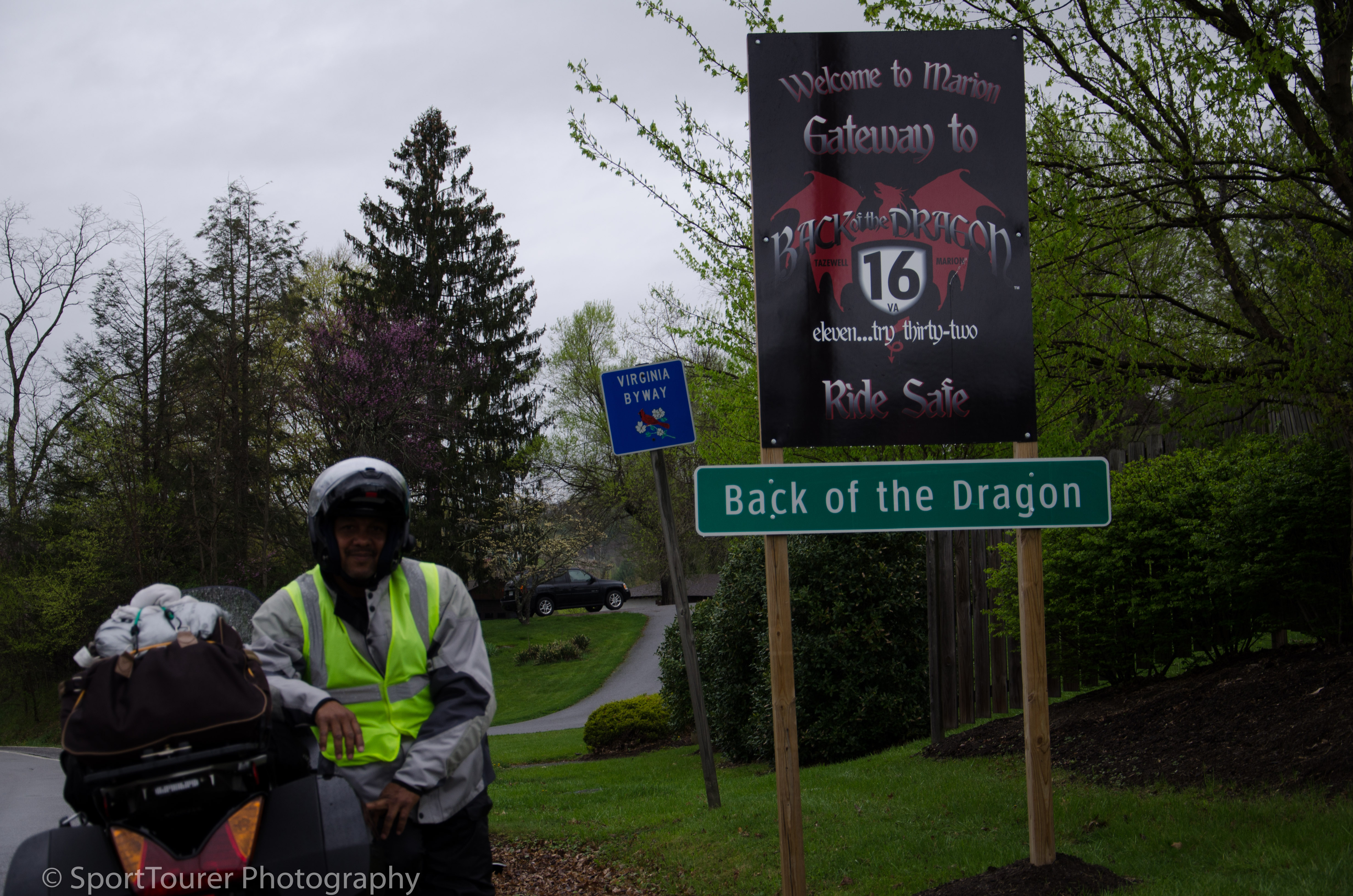
So I checked out but not before noticing a large poster in the reception area advertising “The Back of The Dragon”.
Answering my question, the proprietor was surprised that I did not know of it.
Its starting point was half a mile along main street.
The Back of The Dragon touts more twists and curves than The Tail of The Dragon (US 129) over a distance of 32 miles.
Their advertising campaign draws many bikers to the area and is beginning to overshadow US 129.
The Back of The Dragon is VA 16.
It runs northwards from here through the mountains and finally into the valley town of Tazewell, VA.
I could not pass this up. Besides I felt I would have something to compare to the Tail of The Dragon.
Why not?
Let’s do it!
So after donning my rain gear I headed out, hanging a left turn onto main street and found the junction of VA 16.
Turning north I was promptly greeted by the sign announcing the start of this road of a biker’s delight.
It was a soggy morning.
The roads were wet.
The sky was dull and grey.
But I had on my trusty Firstgear Kilimanjaro riding jacket and waterproof riding pants.
I stayed dry. I was glad I chose the Kilimanjaro as my jacket of choice for this trip.
that was a “no-brainer”.
As a result of my trip planning research, I anticipated inclement weather in this area, so I embraced the conditions. I felt I was as prepared as I could be. Safety, as always would be paramount.
So I got on with the journey.
The road climbed and twisted its way into the mountains.
The bike and I followed.
The cloud of fog was extremely low and hung over the road.
It was thick. Like pea soup. Visibility was less than 30 yds. (27 meters).
I was now down to a crawl.
There were no guard rails, and almost no shoulders, making it very treacherous. One mistake would certainly spell disaster.
The road clung to the side of the mountain - so did I!
With no other traffic on the road besides myself it would not be a good day if I found myself in a situation where I might need help.
I considered turning around to head back from whence I came, but with the road as narrow as it was and no shoulder to increase the margin for error, that was not a chance worth taking.
I soldiered on.
A hairpin turn lay directly at the crest of the mountain.
As I approached it, the road seemed to disappear into the cloud.
My heart was now thumping so hard I could literally hear it, let alone feel it beating in my chest.
The long descent started after that and I gradually began to relax a bit.
We wound around several twists and turns and soon dropped out of the mountains into the valley below.
The road snaked its way through farmland all along whilst the rain kept falling.
Not long after I found myself in the town of Tazewell, VA.
I had safely made it over the mountain and down along The Back of The Dragon.
I pulled into a gas station across from the fire station and sought shelter under the roof of the pump island.
I used the opportunity to settle my nerves and get my bearings.
The rain continued to fall steadily. Did not give me the impression that it would be easing up anytime soon.
Getting back on the road, I found my way to Bluefield, VA and jumped back on to Interstate 77, direction Charlotte, NC.
I motored on and took a forced potty break at the first gas station I came to.

Good time to have breakfast. I used the opportunity.
I called ahead to my buddy Albert who lives in Charlotte to update him on my progress (or the lack thereof). I was on my way to visit and spend a day with him.
Off in the distance I could clearly make out the thick cloud of fog that still hung over and clung to the mountains I had come out through.
Schoolmates back in Africa, we had not seen each other since the summer of 2004. I was looking forward to seeing him again and catching up on our lifelong friendship.
Back on the highway, I blasted my way through the inclement weather.
The rain and fog had been relentless, especially when I got to the tri-state area.
I found myself in traffic conditions where I could not see 18-wheelers immediately in from of me but for the faint glow of their red taillights!
Stopping to pull over at the side of the road and try to ride out the storm was definitely not a good idea. Visibility was too poor. If I couldn’t see them, they sure as heck couldn’t see me. I had no choice but to stay in lane at speeds that were dictated for me by the flow of traffic. Not a good place to be!
Crossing through North Carolina into South Carolina for my obligatory state line photo op, the weather seemed to break a little. It was a welcome condition, especially because I had endured rain and fog since the early morning hours of this day.
Turning around somewhere within South Carolina I headed back into North Carolina, arriving at Albert’s place just before 7 in the evening.
He was out in his driveway in anticipation of my arrival.
It had been 250 wet miles for the day!
It was good to see him again!
We stayed up all night chatting old time stories in between getting my laundry done.
April 15th, 2015.
Day 5.
We were up early, just like in boarding school back in W. Africa and not long after a cup of coffee, I headed out for the day at 6:45 a.m. as Albert left for work.
My destination for today was Westpoint, MS where I’d be visiting with family for a day, via The Tail of The Dragon - weather permitting.
My ride experience in the prevailing weather conditions on the Back of The Dragon (VA 16) had given me cause for apprehension. So I decided to remain flexible with my decisions and make them as I went along based on the conditions I’d find myself in.
I left Charlotte along Interstate 85.
It started to rain again!
I motored on, tentatively.
So far the bike had and was handling really well. So well that it was not even a concern to me. I think the concern was more on my personal being.
Everything around me was wet. The wind was relatively cold. Mixed in the rain was the dense envelope of fog that clung to the land.
This was the 2nd day of this and there did not seem to be any letting up.
Of course there was nothing I could do about it. I had no control over this and all I wanted to do was continue my journey westward as the storm moved eastward, hoping to keep my time through it to a minimum.
Either it was a very widespread and massive storm system or it had stalled over this part of the country. Mile after mile went by with no inkling of blue skies!
At King’s Mountain I exited the interstate system of highways and “jumped” onto NC 74 which was to eventually deposit me in Asheville, NC.
Mid-morning and the rain was now steady, the fog still very dense. I pulled off the road into a strip mall parking lot in Shelby, NC to feed myself and take a break out of these conditions, if only for a little while.

Soon afterwards I got back on the road again with a new determination borne of disappointment with the weather, becoming laser-focussed now with my next destination solely in mind.
By lunchtime, after fighting 18-wheelers for a handful of hours, I exited the highway again for a fuel break.
As I rehydrated myself, I looked around and realized that the rain had actually died down to a very light drizzle, getting less and less by the minute.
I was at the base of the Pisgah National Forest.
I began to feel a sense of relief and excitement. I had been in the rain for 2 riding days at this time.
I decided to wait a little while longer for the water to run off the roads a little more.
So suiting up when I was ready, I took off at this now late hour in the day, wondering whether to bypass the Tail of The Dragon and continue westwards to Westpoint, MS.
But I had come so far, endured so much inclement weather and decided at least to just go to the start of it and take an obligatory picture for myself.
No sooner had I suited up, fired up the bike after gassing her up and turning back onto the road out of the gas station, the rain started again!
Talk about frustration!
I kept myself pointed in the direction of Asheville, NC towards US 129 - The Tail of The Dragon, which would then take me towards Robbinsville and then on to Tapoco.
I was so close but yet still so far from it.
This was the long way to get there because I opted to stay close to the major highways so I could have a quick exit from the area in the event that I decided to change plans and course along the way, as would be dictated by the weather conditions.
Around 3:55 p.m. local time, I arrived in Robbinsville - right where US 129 continues northwards towards Deals Gap and begins the Tail of The Dragon.
I dismounted and set up for a few photos just before entering the town.
Quickly loading my gear back up, I made a quick dash through the town and made that final right turn at a 3-way junction that eventually put me onto US 129.
Made it!
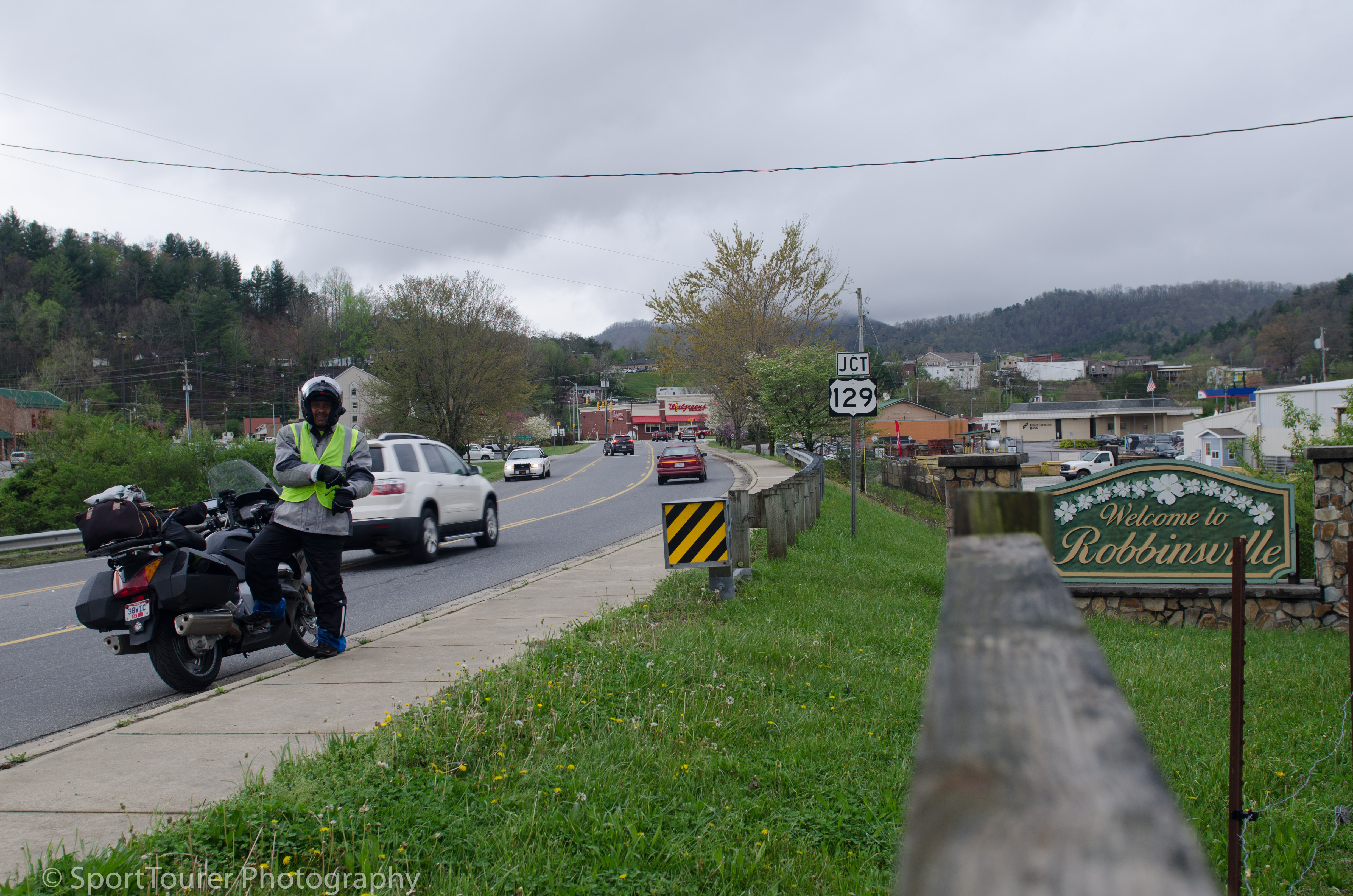
Arriving in Robbinsville, NC, time was truly of the essence.
I Still had far to go and " a road" to ride.
But the raindrops were still of considerable size and falling steadily.
I gingerly pulled into the first overlook, a clearing in the dense growth of the forest right by a lake.
On a clear day I have no doubt that it would be a very lovely view/sight. But on this day and at this time, I could not even see the water body or presence of the lake. That’s how dense the fog still was!
My gloves were wet. I must have drained several gallons out of them as I took them off. I needed to get them off so as I could take that picture as documentary evidence to register my presence at this spot - being on US 129, The Tail of The Dragon!
With pictures out of the way, my thoughts now turned towards the rest of my journey towards West Point, MS.
For a brief while, I could not even figure out which way was east or west. I knew though that US 129 at this point ran north to south. North for me being a lift turn out this overlook.
So as I slowly got to grips with my bearings, guess what?
the rain stopped!!
I looked around me. I thought I could make out some faint “blue” trying to appear through the extensive spread of grey in the skies.
I was not confident.
Suddenly I realized that I was at the start of this widely spoken-about road, easing weather and still a couple of hours of daylight remaining for the day.
Why not?
I quickly donned my riding gear, leaving my gloves off, fired up the bike after mounting my video camera on its perch on the bike, headed out of the overlook parking area and made a turn to the north.
At least I could experience this road for myself, if nothing at all.
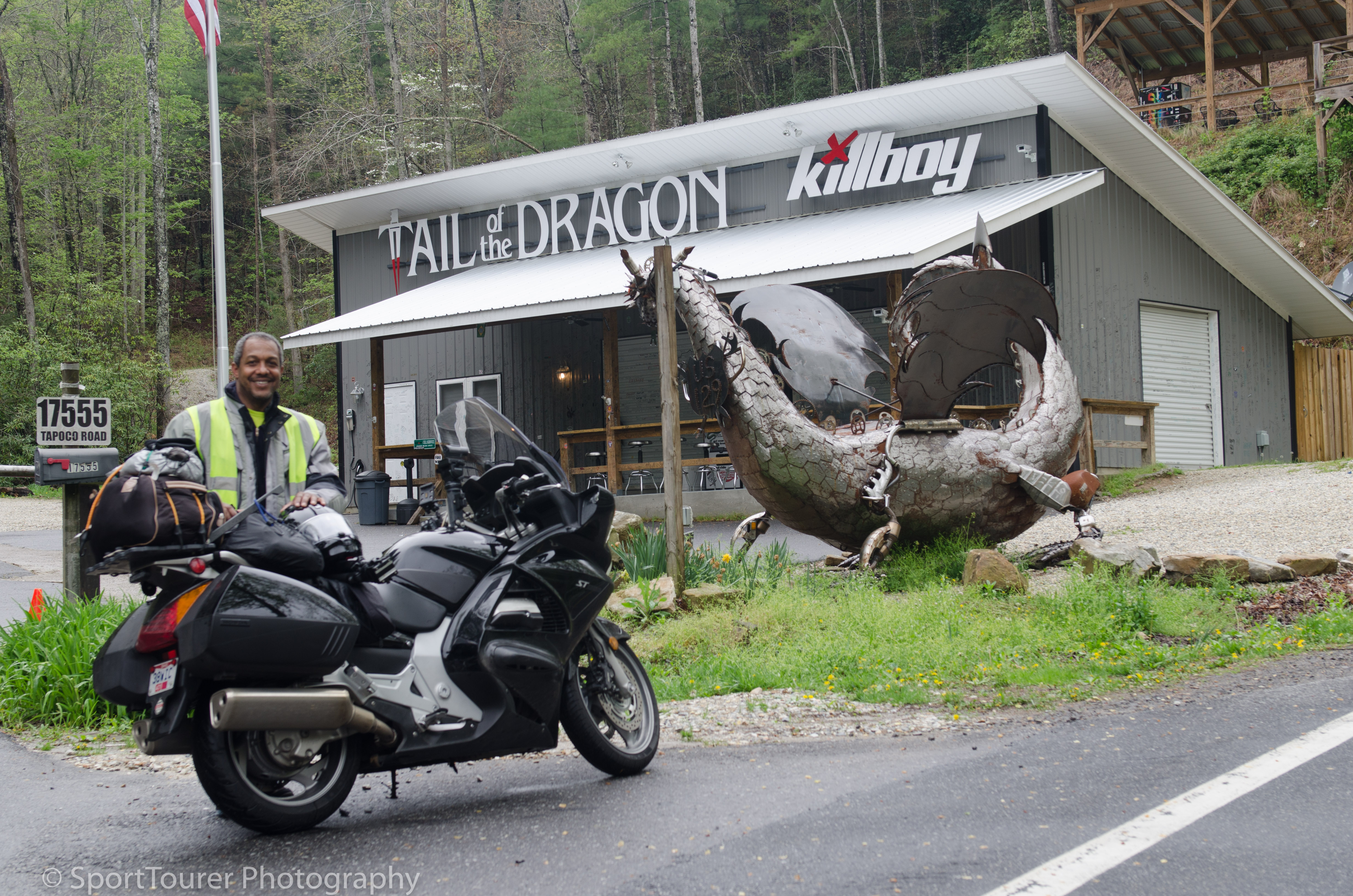
Arriving at Deals Gap, the start of this fabled road, there were only 3 people there.
I got chatting and got one of them to take a couple of pictures of me, after which I promptly began my ride.
As I motored along, the road started getting less and less wet.
My excitement started getting less and less dampened.
My comfort level on the road started getting more and more heightened!
There was no one here. Up to this point I had seen no one, nor passed any vehicle along the way.
I had The Dragon all to myself!
My Michelin tires stuck to the road so well. I began to indulge.
The curves started to come at me.
I was in a groove.
6 VW Golf/Rabbit cars came by in the opposite direction. I made a mental note of that.
I kept on.
The twists and turns of the road were thrilling but not personally challenging.
I cranked up my speed. The bike gave me great feedback. I had a lot of confidence. She was handling very well. Weight and all.
At some parts I was traveling at speeds I normally would not even dream of plying a road in these conditions. But with each passing curve and twist in the road, the conditions improved.
All too soon 11 miles (17.6 km) went by in what seemed to be the blink of an eye!
So now at the end of this road, I felt the desire to ride it in the opposite direction, back towards where I started out and then take a straight shot towards Mississippi. But it was getting late and I did not want to be caught up here in the mountains after dark.
So the decision was to take the long way around through the valley.
So getting back onto the country highway at this point, I pulled into the first gas station I came to, fuelled up the bike, got a Pepsi and a blueberry muffin for nourishment and prepared for the long ride to my next destination - where I should have been arriving at close to this time in the day as planned.
I was way behind schedule. The rain had slowed my journey and cost me time.
But it also made for a very unique experience on The Tail of the Dragon.
How many can say the literally have ridden it all the way and had it pretty much all to themselves?
With the weather conditions as well, I was able to perform an apples to apples comparison of this road to The Back of The Dragon, VA 16. (I shall be writing about this in another section of the website).
So I motored on, preparing for the long night of riding. I had to make it to my next stop today, at all costs, in keeping with my scheduled meeting of family and friends along the way.
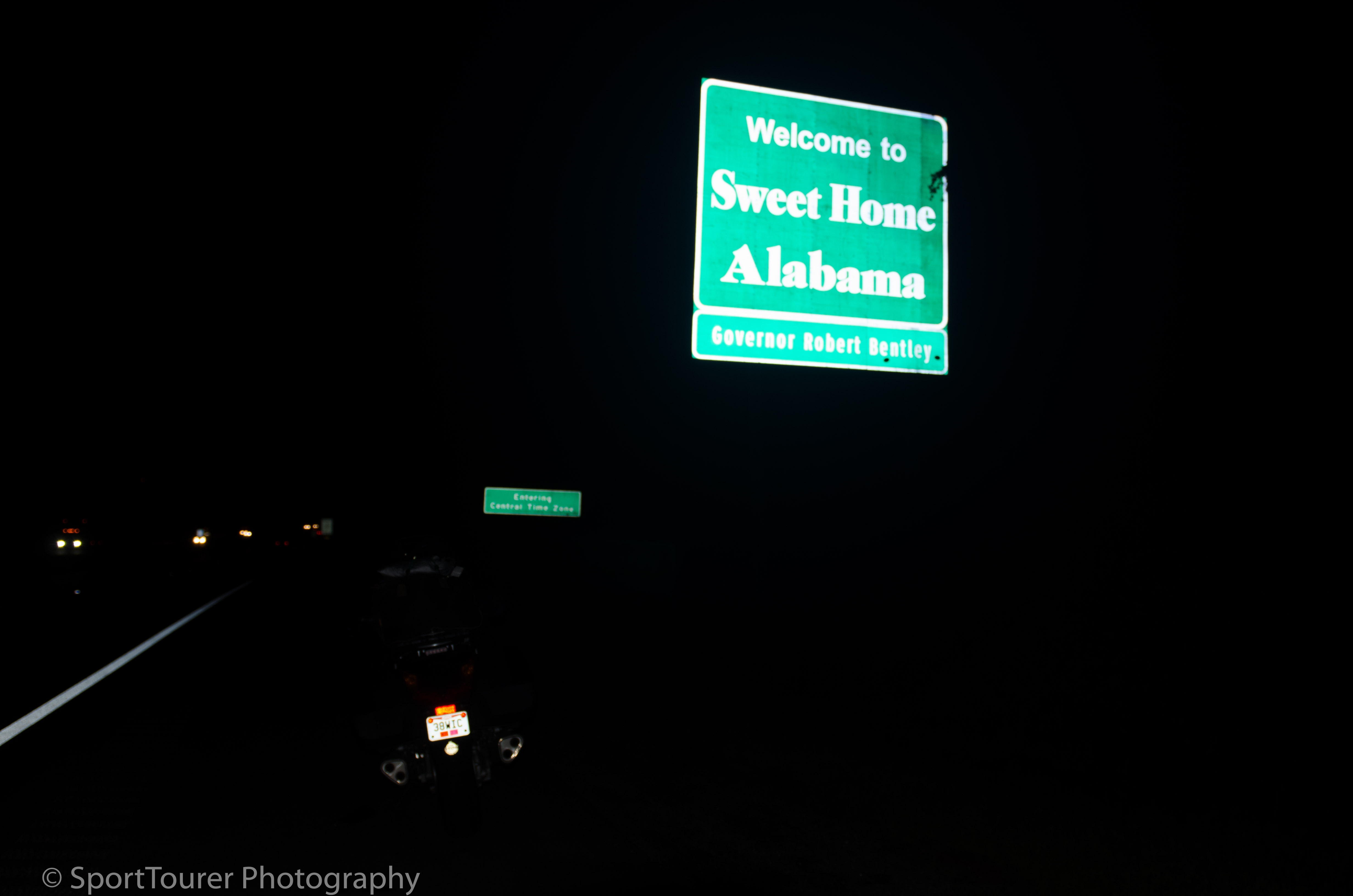
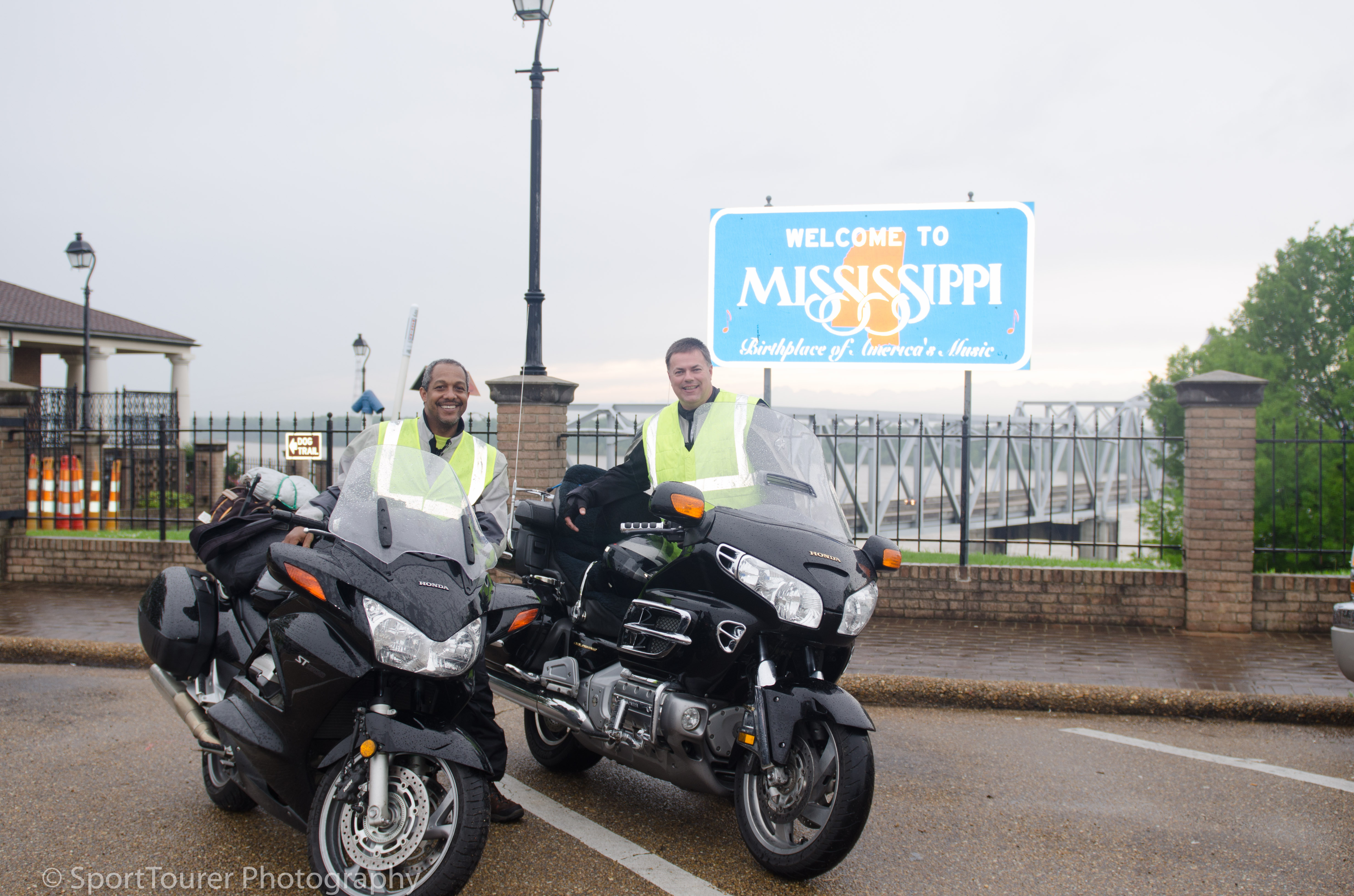
At 10:24 p.m. local time I crossed into Alabama.
Yes, you know the routine - obligatory picture at the state line.
Boy was it dark!
No street lights here whatsoever.
Made it difficult to take a picture for the effect I wanted, but I persevered.
Back on the road.
Hauled a**!
Close to 1:00 a.m. I could hardly keep my eyes open.
I was tired and sleepy.
I had to get off the bike.
I pulled into the parking lot of a closed-down truck stop I came across along the way and took advantage to get some “wake-up” time.
I performed exercise routines to limber up my body and paced the property to help raise my heart rate.
I kept this up for about 35 minutes before setting off.
I needed coffee.
None in sight!
April 16th, 2015
Day 6.
It was a muggy 72’F (20’C) and 3:37 a.m. local, when I pulled into the driveway of my relatives’ home.
They had waited up all night pending my arrival. I made it safely, albeit at this hour of the day.
It was a good reunion.
We stayed up and chatted for a good hour.
It was the morning of a regular working day for them.
I had been on the road for 20 hours straight.
The ST had transported us 694/1110 safe and thrilling miles/km through some very challenging weather conditions.
This ride taught me a lot of lessons.
I garnered a lot of experience that added to making me a more rounded Long Rider.
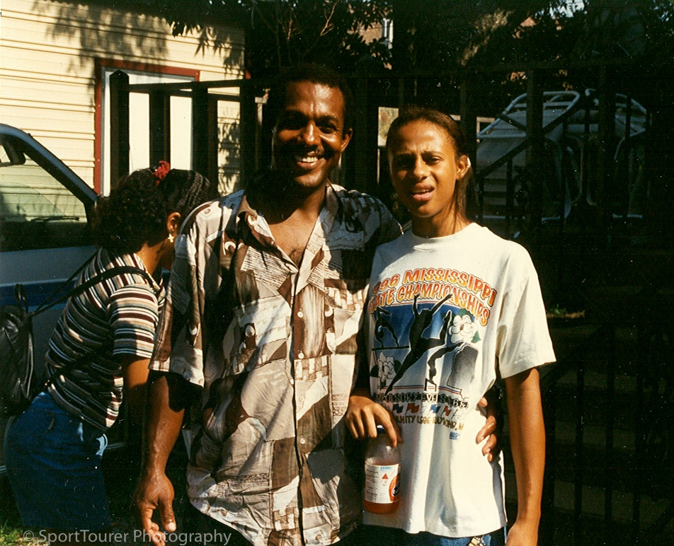
I had not seen Anna since 2004.
Too long. She took the morning off from work and cooked up a wonderful breakfast as my laundry went through their machines.
Remembering my favorite cereal from our growing up days in the early years of the 1970’s, she had “Weetabix” on hand to offer as well.
I was appreciative.
So with video cam running, I repacked and loaded the bike up in preparation for the days’ ride ahead.
I was now headed for Jackson, MS where my niece "Natsy" currently lives. I had not seen her since 1995.
So promptly at 1:00 p.m. we said our farewells and I headed out on the next leg of my journey.
I arrived at Natsy’s workplace in Jackson and visited for about a half hour.
I was amazed at how much she had grown in 20 years!
It cast my mind back immediately to ’95 when she and her younger cousins were all together the last time.
Where are the years going?
We all really need to do a better job of getting them together more frequently than we have over this period of time.

Tooie, Punda, Natsy and Dee.
Hair time for the "Pretty maids all in a row".
1995 West Point, MS.
With Natsy -1995. West Point, MS.
……… with Natsy, 20 years later! Jackson, MS.
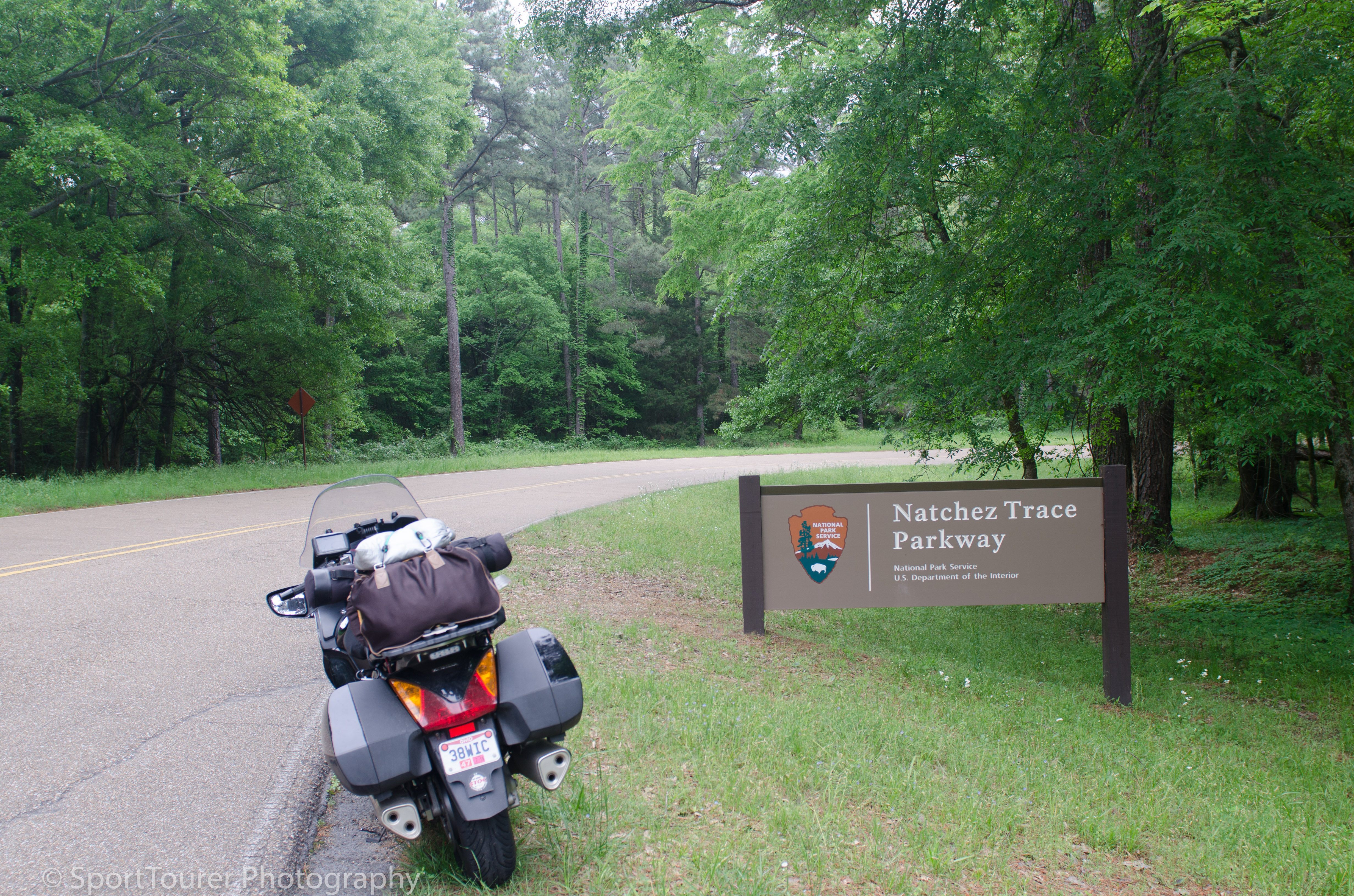
I had several hours to make up for the time I over-spent on the journey yesterday, so leaving Jackson the GPS unit routed us towards the Mississippi/Louisiana set line via the Natchez Trace Parkway.
The road quality of the Natchez trace was excellent. The ride it afforded me was very scenic.
I loved the fact that there were absolutely no billboards and all that commercial hullabaloo! There are purposely no billboards along the parkway to preserve its character.
At first, the Natchez Trace Parkway was probably a series of hunters' paths that formed a trail 444 miles (710 km) long, that led from Natchez, MS along the river, northeast over the low hills and into the foothills of the Tennessee Valley. Hunters followed the bison and then would return along the same pathway with their trappings of fur along the same pathway back towards Nashville to trade, as well as back to the Ohio Valley and today, I followed and experienced part it.
So leaving Jackson, MS I was now headed to an agreed upon rendezvous point on the Mississippi River at the MS/LA border to meet someone I felt I knew so well, someone who felt he knew me so well, even though we had never met before.
……………. read on:
Getting To Meet Wendell.
Wendell and I got introduced through Tony in 2012.
He and Tony had linked up through one of the motorcycle forums online.
Well, he and I continued communicating very frequently over the years to follow.
So we set up this meeting as I was going to be passing through Louisiana on my way to Arkansas to meet up with the rest of the riding group of friends.
Wendell rode out 3 hours to meet me at the state line, welcoming me to Louisiana.
From the instant we met, we felt like we had know each other forever.
So following Wendell for the next 3 hours, we “high-tailed it” to Monroe, LA, his home base where he welcomed me into his home and to meet his “better half”, daughter and Missy, their Chihuahua that took so much of a liking to me - something she never did with other visitors to their home. I guess it meant that I was “okay” in her books. LOL!
It was early evening now and we headed out for dinner, passing by and touring/visiting the TV set of Duck Dynasty which is barely 5 miles (8 km) from where he lives.
We did not realize the time going by so quickly. We were appreciating each others’ company.
" LIKE 2 PEAS IN A POD " !
I still had several miles to go for the day to make it to Benton, AR where I’d be meeting up with the rest of the gang.
Time was now of the essence. I had pretty much burned up all the daylight and much against Wendell’s urging for me to stay, I opted to ride all night again, much against Wendell’s urging.
Leaving Wendell’s home again now at dark, he rode out with me for another hour and a half, depositing me on the Iron Mountain Road, which he knew to be the shortest route to get me directly into Benton, AR.
So after fueling up and with instructions on direction to keep, we said farewell to each other and I headed out into the pitch dark of the night. It was now 10:10 p.m. (local time).
And dark it was!
Not a single street light as the road wound its way into and over the mountain.
I missed the burned out low beam of my bike from the burned out filament of the bulb at this time.
The single low beam light that remained was inadequate for the speed I would have liked to maintain and the high beam only scattered the light more in the now dense fog settling over the mountain road at this altitude!
So slowing down to compensate for safety, I had no choice but to sacrifice my time component.
Each time I switched to high beam for better visibility all I could see were the “Ninja Deer”. Eyes glowing from my lights reflecting through their retinas, each pair of eyes in their groups as they looked up, looked like “Ninja warriors” under cover of darkness with nothing but the whites of their eyes visible.
Took my mind back to the days of watching all those Kung-Fu movies during the 70’s.
I persevered, promising myself to avoid riding this late and in this level of darkness ever again unless absolutely necessary.
With fatigue setting in again I had to stop a few times to “wake myself up”. At my last stop I estimated that I was about 70 miles (112 km) from Benton, AR.
I finally made it into Benton and to the Best Western motel around 1:47 a.m.
With a few hours sleep I awoke slightly rested.
April 17th, 2015
Day 7.
So up and gathered with the rest of the friends I created a photo op and we took off following Henry for a spirited ride in the Ozarks.
Arkansas highways 123, 16, 9, 5, 7, and 10 were all great rides. We cruised around the whole day till late afternoon, passing through the Honda dealership in Russellville as we’ve typically done in the past couple of visits. It’s become one of our traditional stops where we go to admire all the new stuff hitting the market.
I used the opportunity and purchased a new headlight bulb. Luckily it was in stock.
Dinner was typical. Mealtimes together are always special.
We came away from this day with great rides and I came away with decent video footage.
April 18th, 2015
Day 8.
A fast approaching storm had been forecast for today since yesterday.
We awoke to a cloudy, drizzly morning. It didn’t look good.
Out of prudence, I decided to not stay in the area for another day. Besides, I’d had enough rain for the trip as I desired. the storm was moving eastward and I preferred to try and be ahead of it.
So we said our farewells when they all set out for their days’ ride together.
Before packing and checking out, I used some time to replace my burned out headlight bulb and around lunchtime, I headed out away from Benton, northwards toward Tennessee. The plan was to bed down wherever I found myself whenever I felt ready to get off the highway.
At the end of the afternoon, I found myself in Brownsville, TN. I was tired enough, still needing sleep from my accumulated shortfall over the last few days, so I decided to get an early stop, rest up well and then make the last push into Ohio to complete the trip.
April 19th, 2015
Day 9.
Awoke before sunrise.
It’s my eldest daughters’ birthday. I opted to call her later in the day. It was still early.
It was 66’F (18’C) with 100% relative humidity. In other words it was raining steadily.
Here we go again!
I loaded up and after breakfast headed out at 7:50 a.m.
It was to be an unexciting ride today. I was back on the Interstate again…….. and boy, did it rain.
Heavy.
All day, with a slight break as I went past the Bass Pro Pyramid when I crossed the Interstate 40 Bridge over the Wolf River just as I entered Memphis, TN.
Next shot - Kentucky, then Ohio.
I was making decent time.
Home was now within striking distance!
With a good feel for the bike now in rainy weather, I was able to maintain a decently comfortable pace.
With only a brief stop for lunch in Kentucky alongside the highway at a rest stop, and a stop for fuel in Cincinnati, I pushed on for the rest of the day arriving home in 46’F (7’C) at 11:47 p.m. local.
Ugh! this cold Cleveland weather!
So with 29945 miles showing on my odometer, 3,420 miles (5472 km) exactly had been racked up on this trip.
Today, 677 miles (1083 km) of those were ridden.
I had endured bad weather for a total of about 3 full days, met up with friends and family, ridden some much-dreamed about roads and made it home safely.
I began to dream of my next tour.
I was tired, I needed sleep.
I prayed thanks to the Lord for his safe-keep.